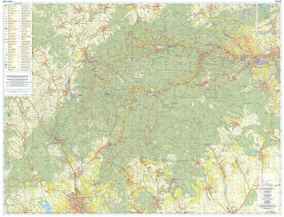
The
itinerary for the walk is below. 5 days of walking, between 19km and 25km each
day. Some pretty good up and down every day. We’ve got some pretty good maps
and trail descriptions. The trail descriptions are even in English.
Each day
looks like it follows the typical pattern of village to village hiking. That is
that vilages are typically in valleys, usually by a water source. And in mountainous
country, villages are as often as not separated by high country; a mountain or
a ridge.
So, a
typical walking day starts with going up. Up to the top of the nearest mountain
or ridge. And it usually ends with a downhill into the village.
Eger to
Felsotarkany 19km 345m ascent 640m descent
The first
day’s walk is described as through vineyards, fields, and cool green forests, with several
river crossings. And over a mountain range. Felsotarkany is small enough that
the evening’s overnight is in an individual’s home. She’s known for her
cooking.
Felsotarkany
to Szilvasvarad 24km 640m ascent 640m descent
Today’ we’ll
follow the Szalajka River Valley north, past prehistoric caves, lots of
waterfalls and several lakes. Lippizaner stallions are bred in Szilvasvarad.
Szilvasvarad
to Repashuta 25km 301m ascent 600m
descent
Forests of
beeches (bukk), panoramas, looking for eagles and falcons.
Repashuta to
Lillafured 22km 310m ascent 600m descent
Lots of
rocky outcroppings, caves, and more waterfalls
Lillafured
to Miskolctapolca
19km 300m ascent
Following a
series of ridges, pass through a couple of mountain villages, and end in
Mikolctapolca, famous for its baths encompassing natural caves.


Alan & Marty
ReplyDeleteThanks for the map and route. I will follow along. Have fun, it looks like a great hike.
John